Windy City suburbs adopt digital technology for first responders
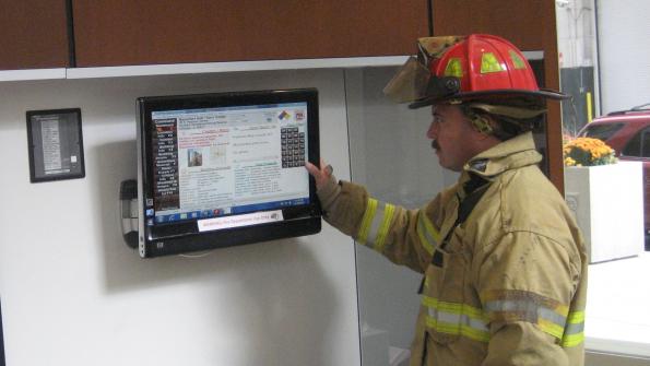
Lincolnwood has become the latest northwest suburb of Chicago to adopt the CommandScope all-digital first responder technology; other communities include Park Ridge and Niles. The all-digital pre-plan program will cover all major buildings in the community and tie in with the neighboring townships. The system creates a network of pre-plan information for primary and mutual aid fire departments.
CommandScope provides first responders with critical knowledge of buildings and its occupants. The affordable system helps ensure the safety of building residents.
“It is imperative for first responders to get critical information immediately and coherently,” says Lincolnwood Deputy Fire Chief Ray White. “CommandScope provides user-friendly technology that assists responders and protects all stakeholders. First responders can act with knowledge saving both lives and property.”
CommandScope pre-plan provides first responders with instant en route access to site plans, floor plans, hazardous material details, utility shut-off locations, geographical maps, fire hydrants locations, residents with special needs and other critical building data. Both neighboring Park Ridge and Niles adopted CommandScope in 2013, while Lincolnwood acquired the system in mid-2015.
“Our previous method of pre-planning was in large bulky books which made it difficult to quickly access current pre-plans and difficult to update and use,” says Niles Fire Department District Chief Robert “Bob” Greiner. “With CommandScope, our team has immediate access to updated information, making our department more efficient and safer, both for the firefighters and the citizenry we protect.”
In Park Ridge, CommandScope augmented an existing Geographic Information System (GIS) shared across 23 municipalities.
“CommandScope pre-plan is a critical component of our response protocol,” says Park Ridge Fire Chief Michael Zywanski. “Along with the GIS network software, CommandScope provides tremendous information not only for our firefighters, but also for mutual aid responders that come in from neighboring municipalities.”
The flexible software platform also allows the fire department to link the technology with the existing GIS database. This feature enables mapping gas transmission mains, hydrant locations, topography, water flow and sewer tracings.
"CommandScope has become a key tool in our response to emergencies,” says Lincolnwood Fire Chief Michael Hansen. “This year, we will expand its use to benefit our Police Department and Public Works.”
CommandScope: www.commandscope.com
_____________
To get connected and stay up-to-date with similar content from American City & County:
Like us on Facebook
Follow us on Twitter
Watch us on YouTube


