GIS for smart cities: Turning data into action
To keep your municipality running smoothly, it’s useful to have a large team of public works employees in the field at all times, keeping an eye out for road obstructions and clogged storm drains. But what if instead of a hundred or so people keeping an eye out, you could mobilize an army of 50,000?
Through the use of citizen-powered mobile apps and state-of-the-art geographic information systems (GIS), municipalities are enabling their biggest stakeholders and most important assets — their own residents — to play an active role in making cities smarter, stronger, and more efficient. These tools are also giving city officials an unparalleled level of insight not only into what is happening throughout their communities, but also where and why.
Yellowing stacks of paper inspection certificates, piled to the ceiling in municipal storerooms, have limited usefulness — except for when a form must be retrieved for scrutiny, or converted en masse to a digital format at considerable cost. In contrast, GIS enables municipalities to forego traditional paper-based forms and even electronic spreadsheets, and go directly to a real-time, digitally mapped system and information that is useful, relevant, and actionable.
Across the country, municipal officials are launching integrated websites and mobile applications that turn local residents into their eyes, ears, and voices on the ground. In Newark, New Jersey, users of the Newark:311 site can report on everything from unauthorized dumping to malfunctioning fire hydrants with the tap of a button. In the City of Dallas, high weeds and litter receive the highest number of complaints on the OurDallas app, with missed garbage pickups coming in third. These systems, which can send users alerts as problems are reviewed and fixed, provide mutual benefit: officials have a better idea of what’s happening and where, and residents enjoy greater visibility and transparency as their complaints are addressed. Gone are the days when you had to call a telephone operator about a missing manhole cover, and then cross your fingers and wait.
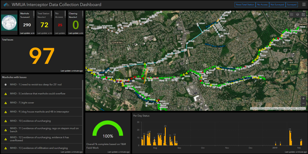
In some regions, these apps are nothing new. But coupled with GIS applications, the power of these technologies for “smart city” applications become readily apparent. For a major East coast-based metropolitan center, for example, our firm developed an interactive map that displays the real-time status of city inspections (fire, housing, and so on). If officials observe that a disproportionately high number of failed fire inspections are occurring within a specific section of the city, an analysis can be performed to understand how or why. Perhaps the buildings in that region are older, or repairs to local infrastructure are needed. A review of this information over time can reveal whether things are improving, or trending in the wrong direction. Informed decisions can be made, and budgets and personnel can be allocated accordingly. The time and resources municipalities can save through the use of these insights can be appreciable.
Of course, the information monitored via such systems is not limited to inspections. Virtually any type of asset or infrastructure can be tracked in real time, on a color-coded map. The deployment of snowplows. The activity of traffic lights. The number and type of building permits issued. If you see that eighty percent of your pothole complaints are coming from the northern part of town, it isn’t difficult to determine where your repair crews and preventative paving plans should be allocated. Just as residents can enter data into these systems, so too can city workers. A manager who can glance at a computer screen and instantly know the status of ten repair jobs is probably more efficient than one who must radio ten different crews for an update.
These systems become even more efficient when people are removed from the equation altogether. Internet-connected water distribution systems, traffic-monitoring cameras, power grids and more can also be added to the GIS mix.
The result? A larger and clearer picture of your municipality, literally from the top down. The ability to make intelligent decisions quickly, and to deploy the right number of resources to the right places, at the right times. Your community is continually producing data with every request, every program, every interaction. The information is there; you just need to begin tapping into the insights. Once you get started, you’ll wonder how you ever got along without it.
James Mawby, CFM, is FEMA Program Specialist at T&M Associates, a leading national consulting, environmental, engineering, technical services and construction management company.


