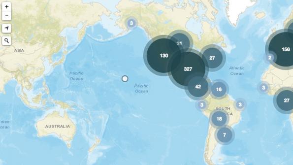
Global celebration of GIS technology
GIS Day, Nov. 16, provided an international forum for users of geographic information systems (GIS) technology to demonstrate real-world applications that are making a difference around the globe.
GIS Day celebrates GIS technology and unites the geospatial community in a global movement of collaboration, sharing and education. Smart mapping and GIS tech company Esri spearheaded the creation of the day of celebration. The first formal GIS Day took place in 1999. Esri president and co-founder Jack Dangermond credits consumer advocate Ralph Nader as being the person who inspired the creation of GIS Day. 
The celebration brings together GIS users from companies, private industries, universities, government agencies, schools, and non-profits. Every day, GIS technology is helping to bring a positive difference across the planet. Through GIS-based geospatial analysis and insights, the technology allows users to solve problems and make smarter decisions about land use, energy, water, natural hazards, biodiversity, climate, and other global issues.
Atlanta GIS Day
In Atlanta, GIS experts from the Metropolitan Atlanta Rapid Transit Authority (MARTA) transit agency showed how Esri’s ArcGIS software tool is helping the agency in its mapping and spatial data analysis. The agency uses the tool to track bus stop maintenance, vandalism incidents and potential locations for solar-powered lights.
MARTA senior planner Ryan VanSickle told GPN that one of the goals of the MARTA GIS Day presentations was to alert other MARTA workgroups about the benefits of GIS technology. “For us, GIS Day is our effort to show various MARTA departments how they can use GIS applications within their daily tasks.” MARTA’s GIS Day presentations were open to the public.
In Toronto, city officials celebrated Geography Awareness Week with presentations on Friday, Nov. 18. In one of the presentations, Toronto Fire Services showed their Mobile Dispatch system and other GIS apps. Toronto’s Geospatial Competency Centre showcased some GIS apps at the Nov. 18 event.


