Nearly a decade since Superstorm Sandy, New York City’s resilience projects are ‘plodding’
Almost a decade on since Superstorm Sandy laid bare the infrastructure shortcomings of New York’s coast, a new report from the city’s comptroller provides a snapshot of the city’s preparedness for the next storm—amid increasingly dangerous storms, the city’s resiliency infrastructure projects are “plodding” along.
The city remains vulnerable.
“This is the moment not only to complete projects commenced after Sandy, but to adjust our plans to address a broader understanding of climate risks (such as those impacted by Hurricane Ida, as well as by recent deadly heat waves in Europe and South Asia) and to make the best possible use of new federal funds, including Ida disaster recovery funds and the Infrastructure Investment and Jobs Act,” reads the report, which was compiled by Comptroller Brad Lander.
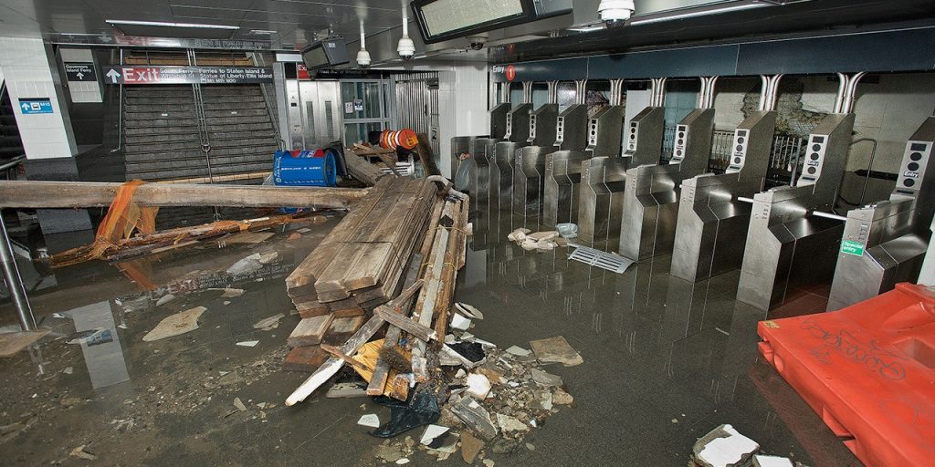
Superstorm Sandy massively uprooted the city’s coastal communities; 43 people died as a result of the storm, which inflicted damages estimated at $19 billion. In the storm’s aftermath, recovery efforts were undertaken through billions in federal aid. Homes have been repaired, mechanical and electrical systems restored, backup generators installed, residents and businesses reopened, and infrastructure resilience projects initiated.
“However, progress to implement these projects has been plodding,” the comptroller’s report says. “As the city continues to advance its resiliency capital investments, much of the city still remains vulnerable to coastal flooding and sea level rise.”
At least in part, this is because there remains a substantial amount of aid funding that hasn’t yet been used.
Specifically, the city still has about $4 billion left to spend from its $15 billion in federal recovery grants (having spent about $11 billion), a little more than 65 percent of its $10 billion in FEMA aid, and almost all of its $4.2 billion HUD CDBG-DR grants remaining. That doesn’t include the city’s own capital contributions: “The comptroller’s under-the-hood examination of total project budgets and actual liquidations shows that the city has spent only 13.3 percent of the $1.9 billion (East Side Coastal Resiliency) budget,” the report continues.
As ocean tides rise and more named storms develop annually with each passing year, the city and its fiscal stability are increasingly at risk. This risk is compounded by increasing real estate prices. Since Superstorm Sandy, real estate in the region’s 100-year floodplain has increased to more than $176 billion—a 44 percent increase. By 2050, the report projects another $242 billion in current market value will be at risk of coastal flooding—in correlation, a major revenue stream relied on by the city is in jeopardy. These communities in the floodplain are estimated to generate $2 billion annually in property taxes.
Public housing will particularly be impacted—17 percent of the city’s public housing units are in the 100-year floodplain. That number is expected to grow to 26 percent by 2050.
And it’s not just real estate that’s at risk.
“Significant essential infrastructure lies in the 100-year floodplain, including: 79 percent of transportation and utility land uses that support our electric and gas utilities, rail yards, airports, docks and piers, bridges, tunnels, and highways,” the report says. The majority of the city’s open space and recreational areas are also in the floodplain, along with “46 percent of the city’s industrial and manufacturing that house waste transfer stations, construction businesses, warehouses and distribution centers—industries on which our local economy and supply chain rely.”
Faced with the reality of a changing climate, the comptroller’s report calls on city leaders to “accelerate the pace of incomplete resilience projects and future capital projects,” develop a “long-term resiliency plan” that considers land use changes, and “codify design guidelines for resiliency infrastructure,” among other actions.


